Milton Neighbourhood Forum Statement of Case
Against Applications 20/00204/FUL and 20/00205/LBC
We are providing this Statement of Case in absence of sight of the Core Documents.
In addition to the comments made to PINS on 14th September 2022, the comments within this Statement of Case should be read in conjunction with the Neighbourhood Planning Forum Objections to the LPA of 15th March 2020; 16th March 2021; 27th October 2022 and 21st November 2022 (mistakenly drafted as October but is in response to the public release in mid-November 2022 of the Appellant’s Open Space Note of Dec 2021).
Preamble
As early as 1961 a political decision was taken to replace psychiatric hospitals. This was accelerated in the 1980’s with care in the community. St James Hospital was listed in 1989 in response to the rapid disposal of these heritage assets. At the same time an application was considered to convert the Hospital to an hotel/training centre.
The Cabinet Office has clear instructions for those proposing to dispose of surplus government estate. Guiding the seller to Historic England’s advice which specifically cautions against fragmentation and “picking off” more profitable areas and is particularly relevant to former Hospital and Military sites. By 2014 if not before PCC was informed that the hospital was being wound down and operating essentially as an administrative facility
The failure of the seller to bring the two remaining parcels of land to market together has unnecessarily loaded the costs of a challenging conversion onto this one scheme.
Summary
The intensification of development adversely impacts heritage and landscape,
The quantum of new development exceeds the aggregate footprint of original structures following demolition of buildings with the former Hospital airing courts being encroached upon and valuable open space lost.
The justification of improved public access is unreasonable, and a more appropriate development could have been master-planned with greater adherence to Historic England’s Guidelines on the disposal of public land with heritage assets.
The site’s intensification is detrimental to the local community with increased traffic on congested local roads increasing degradation of air quality.
Heritage and Setting
The Grade II Hospital sits within a designed verdant landscape including east and west airing courts. The northern parts of both are harmed by the intrusion of unsympathetically designed houses and car-parking.
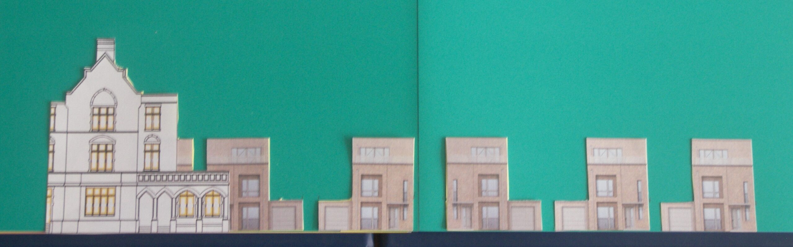
“Harrisons” emerge from behind Overton and extend to Chapel View
The Curtilage Listed Edwardian Villas (known as “Falcon House” and “Baytrees”) overlooking the eastern airing court from the north will become visually disconnected from the Chapel by six of the nine three-storey “Harrison” type detached houses ruining the open character of the setting of the Hospital’s eastern wing as seen below.
East Airing Court from the south.
The Hospital and the Villas are closely related in terms of historical medical context, with no physical barriers between them and being ancillary, the Villas are considered part and parcel of the Hospital Building. The Chapel is also Grade II Listed. The Hospital, the Villas and the Chapel were functionally linked at the date of Listing; visually connected in the open landscape; and physically connected by the road named “Chapel View”,
Historic England’s letter of 24th March 2020 to the LPA questions the justification for the harm to the setting.
The Examiner’s Report (para 4.13.4) to the Milton Neighbourhood Development Plan (MNDP) explains the green land north of the Chapel “has a heritage importance as open space” in relation to the setting of the Listed Chapel and Hospital building:- it requires the land to be “protected from an indication it is available for development” because of its potential heritage value as setting for Listed Buildings. This is the land immediately to the right behind the Chapel edge in the above image.
The current Historic Environment Good Practice Advice from Historic England explains how views from the surrounding landscape contribute to the setting and significance of a heritage asset.
PCC’s Conservation Officer on 5th March 2021 advised the Hospital had “High Significance” in terms of scale, form and architectural detail, and that it also sits within extensive “park-like” grounds, the scale, maturity and character of which contribute very significantly to the overall value of the site:- an extreme rarity in Portsmouth.
The Conservation Officer was also concerned with the number siting/disposition of the new build houses and their impact on views, which he considered quite high (in terms of their potential to generate undesirable impacts). We will explain at the Round Table Sessions why we consider that impact to be very high.
The 2020 Design Review was as critical of the excessive parking and the impacts on the setting of the Hospital as we are. Para 3.3 therein required a review of the parking strategy but instead of reducing the level of parking, it increased between the initial Planning Committee of 12th January 2022 and the subsequent one of 21st December 2022, from 370 to 388. Policy TSP 2 in the MNDP recommends the parking limit be 304 including 10% for visitors (25) and 26 for the Cricket Ground/Club.
As the Historic England Guidance explains, the contribution of setting to significance does not depend on public rights of access.
Open Space and Trees
We have shown in our submission to PINS of 14th Septemberwhy there is an overall net loss in Open Space in terms of the immediate surrounds of the Hospital building and at “Matron’s Garden”.
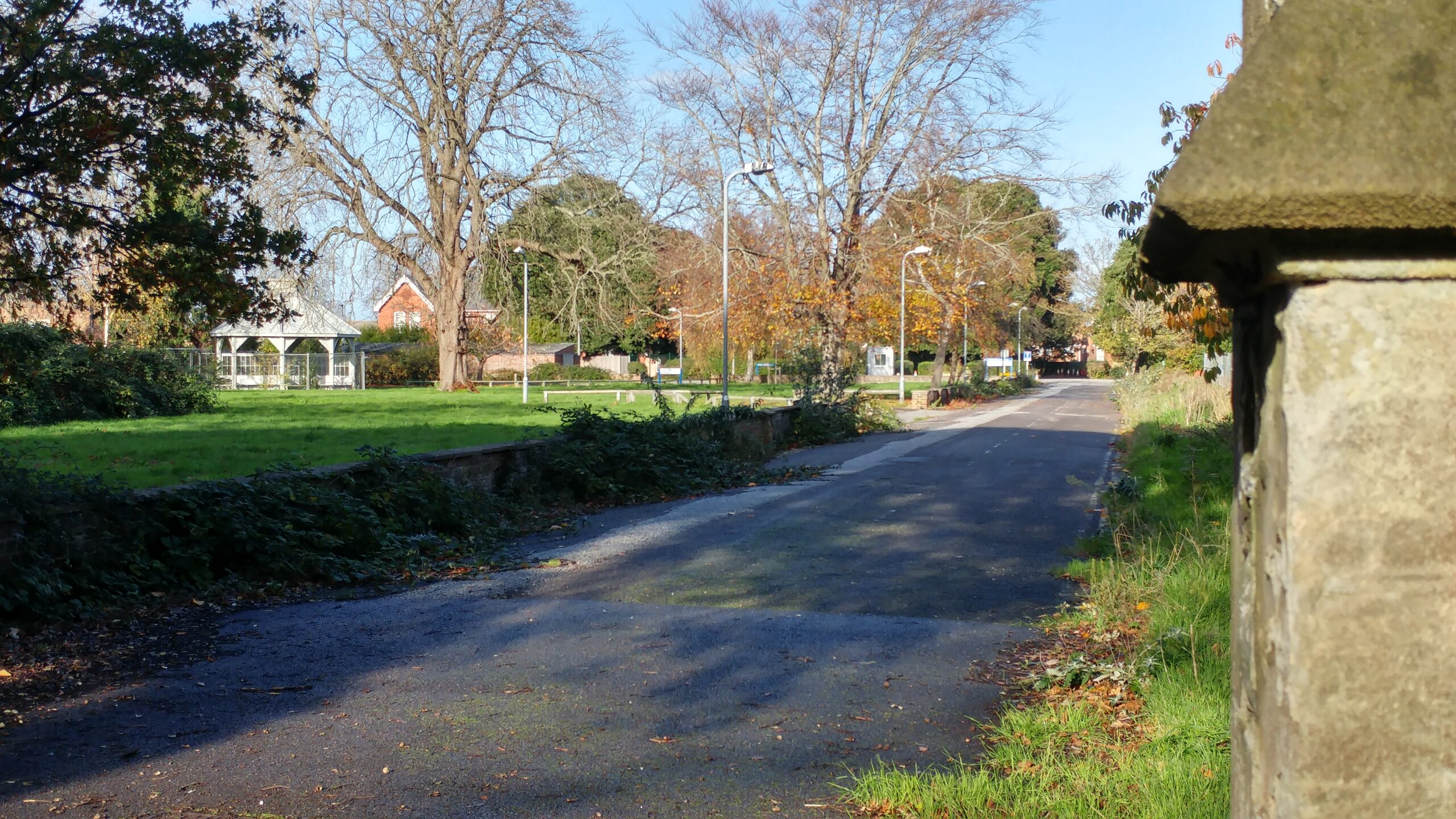
We have explained in our final submission to the LPA in November 2022 the qualities of the “Garden” including its trees. We described it as a unique enclosure not replicated elsewhere in Portsmouth and why the LP and the MNDP includes Policies to retain and enhance existing open spaces. Similarly, the Conservation Officer (see above) has stated the parkland landscape is a rarity in the context of Portsmouth. “Matron’s Garden” is a significant feature of that designed landscape which excluded buildings immediately south of the main frontage and north of what is now known as St James’ Green .
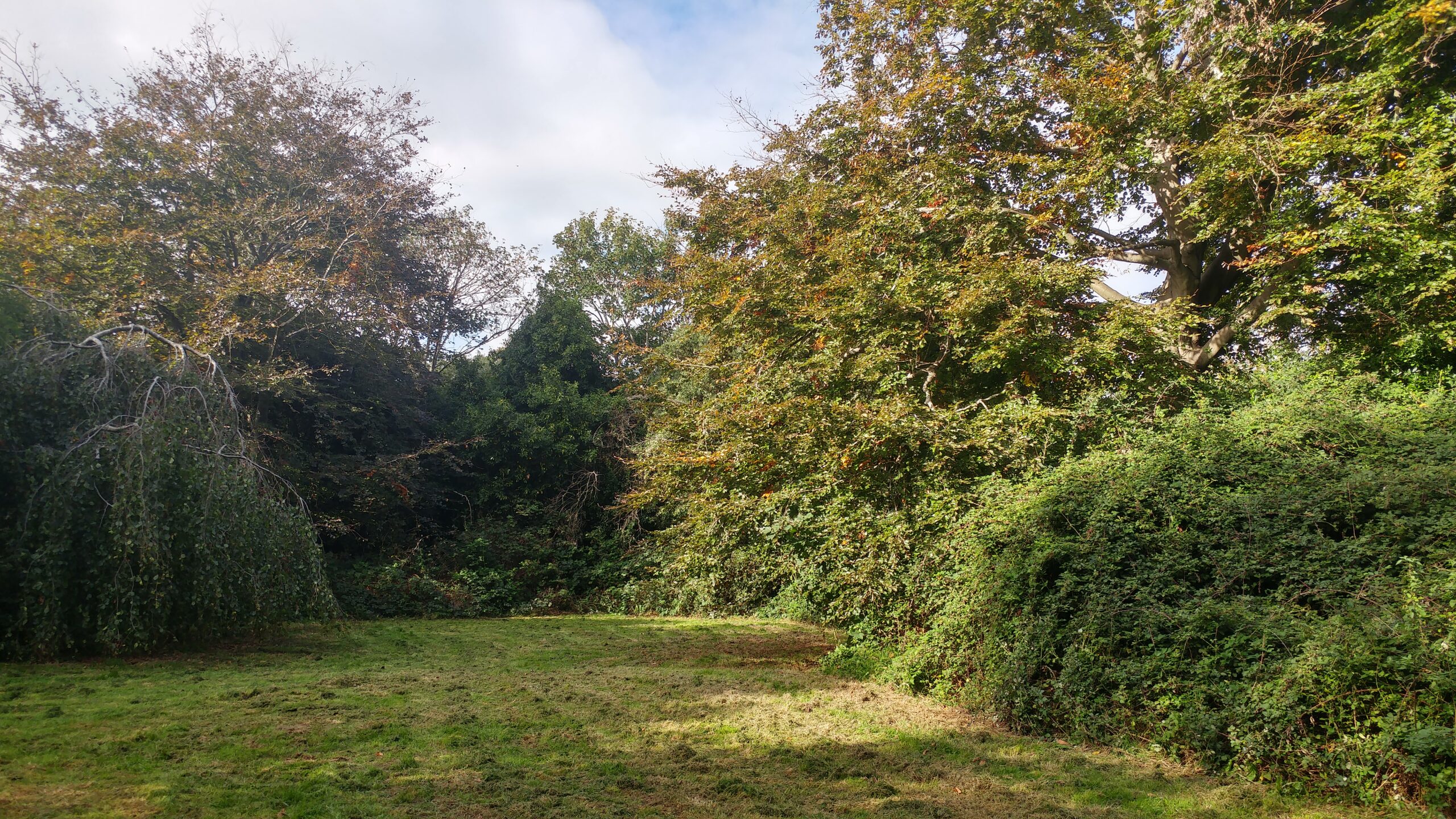
“Matron’s Garden” looking west.
Since November 2022 Public Health has issued the attached Note (see para 2) on the contributions Green Space has to the health and wellbeing of residents, to the City’s “Greening” ambitions, in mitigating urban heat effects, and absorbing atmospheric pollution and CO2, all of which emphasises the case for its retention.
We have previously explained the public had already been invited by the NHS onto the site for walking and jogging purposes but that in any event PCS 13 is not a Policy for Public Open Space, as evidenced by its application to the adjoining University site at Langstone Campus. It is a Policy primarily for Open Space retention and enhancement in a City with huge deficits thereof.
PCS13 (and hence the MNDP Policy ENV1) require the creation of additional “pocket parks” on developments in excess of fifty homes to a standard of 1.5ha per 1,000 population. Using PCC’s current Housing Standards SPD, the estimated number of new residents occupying the proposed new development would be 436. We estimate the loss of open space to be in the order of 7,000m². Whereas policy PCS13 requires the provision of an additional 6,540 m² new space.
Local Road Capacity and Traffic Congestion with associated risks to Air Quality
Saved LP PolicyMT4 and MNDP Policy TSP1 require that additional traffic from new development be satisfactorily accommodated on the surrounding highway network. The main roads the site will access, and egress are the Eastern Road (A2030) and Milton Road (A288).
In an application for a residential scheme of 134 new homes submitted in May 2019 (19/00420/FUL) at Fraser Range, the LPA were advised on 24th February 2023, that the Highway Authority would lodge an objection due to the inadequate assessment of the likely highway impact resulting from the development. This development relies on both the A288 and the A2030 (albeit not exclusively).
The LHA advised that since Covid vehicle numbers using the network had significantly risen and referenced the DFT counter (Site Number 56297) along Eastern Road. This site recorded higher vehicle numbers than those pre covid and the evidence submitted had not considered the wider increase in vehicle trips during 2022.
The applicants had therefore not provided an appropriate assessment of the likely highway impacts resulting from the development and would need to resurvey the highway conditions before a formal assessment can be made.
The LPA was therefore advised that should it be minded to make a determination in the absence of an updated assessment, it should include the following reasons for refusal:- “The proposal involves development that cannot be reconciled with the National Planning Policy Framework in that the proposal fails to appropriately assess the development impact on the existing transport network. This could result in a severe impact on the road safety and operation of the local transport network contrary to the NPPF 2021”.
The last reported advice from the LHA to the LPA regarding the Appellant’s Highway Assessment was in a Memo dated 29th September 2021. It explained a traffic light junction would resolve the operation of the Locksway Road/Milton Road junction. However, this is dependent on Cumulative Transport Assessment for St James’ relying upon traffic flows relating to the network peak of June 2019 surveys “moderated to reflect the land use fall back assumptions the LPA found sound in the addendum TA to establish the base case”.
That LHA advice of September 2021 in respect of St James’ pre-dates the LHA’s advice of February 2023 in respect of Fraser by seventeen months. We must therefore conclude the Appellant’s Assessment is also out of date.
Policy MT4 was drafted for the 2001 to 2012 Local Plan and specifically cautioned decision makers that the highway capacity be capable of satisfactorily accommodating the additional traffic generated from the Hospital’s redevelopment. We suggest that was with the full knowledge of highway limitations in 2001 and that the Hospital was a Psychiatric Hospital and not a General Hospital as otherwise, the same caveat would have been imposed on policy MT3 covering phase 1.
The Eastern Road serves the Appeal site, and we included 2017 images of congestion thereon together with the Milton Rd/Goldsmith Avenue Junction in our September submission to PINS.
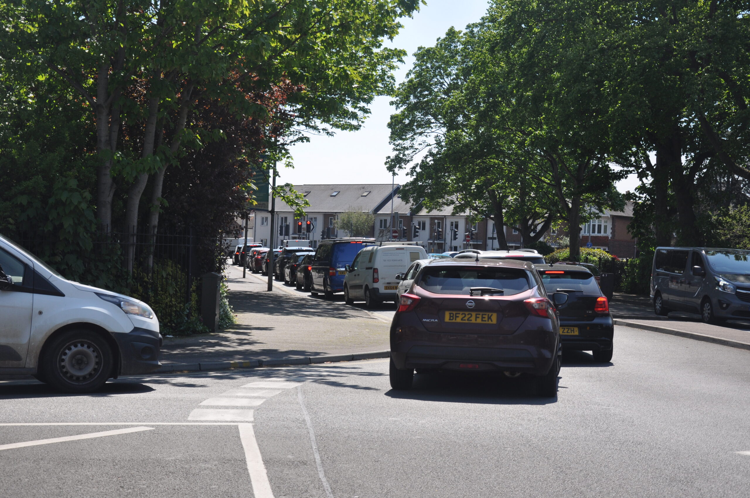
The image below shows a recent example of congestion at the Milton Rd/Locksway Rd junction with stationary cars blocking the roundabout preventing egress from Locksway Road onto the north and south lanes of Milton Road. This is not a peak-time event but an ordinary Saturday in May. It’s not a Bank Holiday and nor is it one where Portsmouth FC has a home fixture.
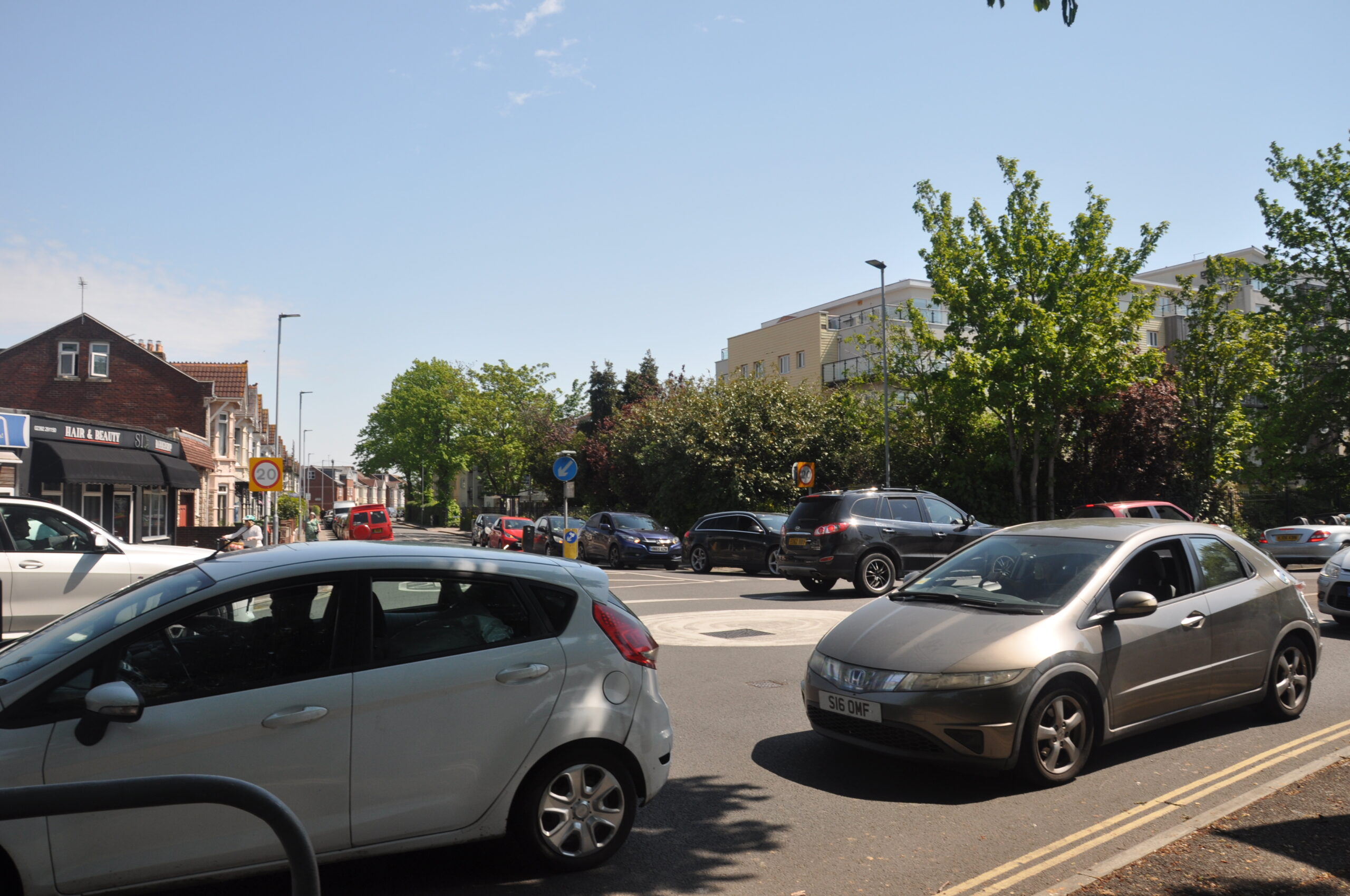
Milton Road/Locksway Rd Junction looking east.
The LHA in its advice to the LPA of 21st March 2021 estimates the road space between Locksway Road and Goldsmith Avenue can accommodate approximately twenty vehicles. The second image below taken on the same day shows why it can’t.
Milton Road/Locksway Rd Junction looking south.
We have explained in our letter to PINS of 14th September why we had doubts that advancing the stop line in Moorings Way was feasible. PCC’s evidence papers to the emerging Plan include a Local Transport Assessment done in in 2020 by “SYSTRA” and it concluded the junction at Moorings Way and Eastern Road could not be mitigated because of “tracking with larger vehicles” (otherwise known as a No 13 Bus https://www.portsmouth.gov.uk/wp-content/uploads/2021/09/Portsmouth-City-Council-Local-Plan-Modelling-TA-V4-231020-_compressed.pdf We have to assume the stop-line cannot practically be advanced.
We are not highway experts and cannot argue transport modelling one way or another. However, we have reasonable grounds to assume the existing highway network cannot satisfactorily accommodate the additional traffic generation required to comply with MT4 and TSP 1.
If the highway network cannot accommodate the additional traffic, it is also reasonable to assume Air Quality will suffer too. In that respect there is no justification for proposing parking levels in excess of Policy standards. TfL research of 2012/15 (see PH Note) determined increased parking levels results in increased vehicle movements.
The Appellant’s AQ Assessment is dependent upon the 2018 AQ Annual Report and that can no longer be relied upon in 2023 if traffic levels have increased and road traffic accounts for over half the City’s air pollution levels.
The Appellant’s development feeds directly into AQMA 9.
Absence of Justification within Historic England Guidance
The submission to PINS of September 2022 identified Historic England Guidance as relating to this development.
That Guidance:- https://historicengland.org.uk/images-books/publications/disposal-heritage-assets/guidance-disposals-final-jun-10/ makes clear that large sites should be considered holistically to avoid isolating heritage assets and potentially damaging their setting. With a more considerate Masterplan embracing both phases of the disposal coherently, the Hospital’s redevelopment could have created a less intensive scheme with Listed Building costs being spread across the whole site. Price is not to be the overriding objective and it specifically cautions against fragmentation and “picking off” more profitable areas and is particularly relevant to former Hospital and Military sites.
Conclusion
St James’ Hospital provides a wonderful opportunity for an iconic development.
Policies in the Portsmouth Plan and the Neighbourhood Plan have been incorrectly applied resulting in a non-compliant scheme failing in the following respects:-
- Harm to the setting of the Grade II Listed Hospital visually from poor layout and design, particularly at the northern end of the eastern Airing Court where the special relationship with the Hospital, Chapel and Non-Designated Villas is broken.
- Quantitative and qualitative loss in Open Space and trees with adverse impacts to health and well-being, and inevitably resulting in biodiversity stress. Matrons Garden particularly, is a significant and relict feature of the designed and ‘private’ landscape that precluded building immediately south of the main front.
- Unquantified negative highway impacts from an already congested network exacerbated by excessive parking levels which further add to heritage harm and open space loss.
These are clear reasons for REFUSING the application especially when considering the application site forms part of a wider Hospital estate, still in public ownership, not yet determined or disposed of, and capable of affording a more comprehensive, coherent and less harmful scheme.
Section 38(6) of the Planning and Compulsory Purchase Act 2004 requires decision makers refer to the relevant Local (and Neighbourhood) Plan Policies in determining applications. The Policies within the Local and Neighbourhood Plan on heritage and design; open space and environment; and highway impacts are relevant and material.
The absence of a five-year housing land supply or any non-fulfilment of a Housing Delivery Test where the principle of residential development is accepted, is irrelevant to a scheme where there are no “Significant and Demonstrable Benefits” outweighing harm.
The appellants reliance on the “Tilted Balance” is overstated.
Rod Bailey
Rod Bailey
Milton Neighbourhood Forum Planning Group
26th May 2023
St James planning appeal – Statement of case